Backpacking the World

These first three posts are for the reader to understand where I am coming from, my experiences in the past, how I got to this point, and where I want to be in the future.

I'm looking forward to finalizing with more New Zealand posts in the very near future, and writing you a greeting from the land of 13x as many sheep as people!! 50M to 4million!!

Friday, January 27, 2012

The Routeburn Track - 13 Hours, 14 Miles, & 1 Vertical Mile of Elevation Change


December 28, 2011

What.A.Day. Exhausting, but unbelievably worth it. It started when we awoke to the sunlight filling our room and the rustling of fellow trampers getting their gear ready for the day. We hit the trail at 8am and did not finish it until almost 9:30PM. Yes, 13.5 hours of hiking with all our gear on our back, up a vertical half a mile, down a vertical quarter mile (so we climbed up the sears tower twice and down once eseentially) and that's not even accounting for the constant up and down that the trail has as you walk its course. 14 horizontal miles later, we arrived at Lake Howden. Here's how we did it and the highlights along the way:

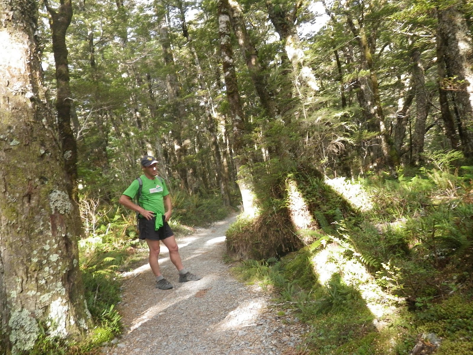
Routeburn Flats Hut to Routeburn Falls:
We left the picturesque plains of the Flats hut and made our way up to Routeburn Falls, a short 2.5km hike, but it was a grueling vertical the whole way, about a 1,100' vertical increase. Most of this was through a forested path, until the path just opened up. We were at the site of a previous rock fall that cleared the entire view of the flats below.

Routeburn Flats Valley Below where we started this morning:
Stunning view #9283 for the trip thus far. We tracked on, across various 1 person wide bridges, suspension bridges over ravines, and took in the water falls as we went along. We reach the falls hut, went to fill up our water supply, as a mist began to fill the air, and the temperature dropped. Who do we see? James, Ben and Sarah! Timing would have it such that they were ready to tramp on as well, and we continued our hike with them, give or take, 50m separating us on the trail at times, other times walking together, other times further apart, however the trail took us.

Routeburn Falls Hut to Harris Saddle:
The track begins as punishingly as it has yet to be. Switchbacks up slick rock with bits of moss on the rock, as we careen pass a thundering water fall. The Routeburn Falls wasn't a picturesque one stream of water, it was a wide valley, over loads of boulders and several tiers as it made its way down the mountainside.

Routeburn Falls
Slick Rock climb on the track:
At this point, we have gone from shorts/short sleeves to start our hike this morning, to 2 long sleeves, fleece, and rain jacket, and I zipped my pants on. We continue on into the next valley, and it doesn't seem to end, we keep our heads up looking to see where the track could possibly lead us and it just keeps going and going! Tim and I picked out a boulder in the distance and estimated how long it would take us to get there, we set the over/under at 30 minutes, and it took us 31 minutes, I'd say it was a pretty good / really lucky guess. Trecking on through this vast valley (we are no longer in the trees) enjoying views of the valley strewn with a random assortment of massive boulders throughout, and 2 streams feeding into one which fed the Routeburn Falls.

Part of the trail, through the boulders:


We note that we're heading upwards to the top of this stream which is a very gradual water fall. It seems to never come, onward we go, and finally reach it.....expecting a stream on top...we are shocked to see the gorgeous Lake Harris. Nestled at an altitude of about 4,000 feet, it is continually filled by the rains / snow melt before the water makes the long journey down to the lowest part of the canyon where we started our track yesterday.
The Routeburn Flats Valley where we began this morning in the middle of this picture:

The views were stunning as we hugged the edge of the canyon, with a shear drop off the right to the Lake below.

We reach Harris Saddle, the highest point on the Routeburn Track, take our packs off, for our backs sake (we've been hiking 5 hrs at this point) and eat a delish peanut butter & nutella sandwich. Water we continue to fill from the natural streams as we go. We break shortly before taking a side hike up Conical Hill.

Conical Hill:
The fact that this is called a "Hill" is a joke. It's less than 1km hike, but goes up a vertical 700 feet. As this is a round trip hike back to Harris Saddle, we leave our bags here, because if anyone wants to steal our stuff...well...then they have to carry it 10+ miles back to 'civilization' (read: "Roads") and a further drive to any civilization. We hike on, and come across our first snow match, naturally, we have an abridged snowball fight, while wearing shorts and a long sleeve, only due to the breeze.

It has warmed up again and the sun is shining bright. We hike up vertical rock faces to make progress and about half way up, we are treated to one of the most stunning views thus far.

Lake Harris (and on the right you can see the trail we came up)

Lake Harris as it dominates the landscape below and the path that we trekked up a mere hour or so before. Continuing on, we had to hike over patches of snow, and we were all exhausted. Quads were killing us. Ben was joking with us as he was up ahead saying "this is the top" and it never would be, then he sounded truthful and he was.

Climbing onward:
The top was incredible. I literally felt like I was on top of the world. You could see one of NZ's famous fjords in one direction, snow capped mountains in every direction, and the beautiful Hollyford Valley below.


Top of Conical Hill:


Top of Conical Hill, Above the clouds:

We soaked in the views, took videos, panaramic pictures, as the wind WHIPPED across the top at a pitch loud enough that it could interrupted conversations. Off in the distance, Tim and I saw a lake and we said, "God I hope that isn't Lake Howden" (our final destination of the day) already being semi-winded and knowing we have a long day ahead. I couldn't be convinced that it was it, in retrospect, it definitely was - and it was definitely as far away as it looked.

Yep, right there in the middle, just below the clouds, that is Lake Howden: We've already hiked 5+ hours today and we are going to ultimately end up there later tonight. I cannot believe we made it.

We trekked down Conical Hill retrieved our bags and continued on, it's mostly downhill from here.

Harris Saddle to Lake MacKenzie:

We left Harris Saddle at an elevation of 1,277m


The trail towards Lake Mackenzie from the Harris Saddle:

and trekked down the mountainside. No more than even 45 minutes later, and we looked back up at where Harris Saddle was and more importantly the peak of Conical Hill and we were stunned by the fact that we had hiked that high.

Conical Hill on the left of the photo where we just previously were:
Our views for this 8km or so hike were constantly of the Hollyford Valley below. We passed water falls where we filled up our water, made mixed drinks of raspberry sugar & water and continued to trek on.


There were probably 30 or so white, industrial sized, 500KG (1,100 lbs) bags of crushed stone that must have been meticulously dropped off my helicopter and placed on the path that served as more obstacles for us to crawl over. This was annual maintenance to restore the path and prevent it from eroding down the steep slope carved by the Hollyford River below, heading towards the fjord I mentioned earlier. Below, we also saw a town with one road heading in and out, it looked like the Dharma Initiative from Lost and even with my binoculars, it was hard to detect any life, other than parked cars below - we were that far away and that high still.

Finally, we reach a flat, stopping point, Tim and I catch up to Ben, Sarah, and James as they had tramped on when we stopped to make our mixed drinks, and wash my socks in the stream, and they waited for us to catch up as we took a break, and snacked on granola bars, dried apricots that Sarah had been carrying, among other things. Our next turn leads us to a view of a Lake, at least 500' below us, Tim and I pray that somehow someway its Lake Howden, but we know it has to be Lake MacKenzie.


Switch backing down mountainside we go, back into the trees and a land that can only be described as something out of Dr. Seuss's books.


Moss everywhere, a whole new world from where we were just in above.


We arrive at Lake MacKenzie, set down our bags, and James/Ben said they were going swimming before they started the track, and despite the cold and frigid lake temperatures of the snow run off - they did...and it was great fun for all of us who were watching.

They jumped into the lake from the shore on the side, they let out shrieks, as the serenity of the valley and the snow peaked mountains in the back drop peacefully looked down and laughed at them alongside Sarah, Tim, and I.

We said our good-byes to our three friends, hoping to see them in Queenstown in New Years, but realizing we'd likely never run into them again. It was great traveling with them, and that's one of the best experiences of travel. The friends you meet and your interactions with them. I ate 2 more PB & nutella sandwiches, took an obligatory picture of the trail map saying 3 more hours til Lake Howden, and 8.6km and Tim and I trekked on.


Lake MacKenzie to Lake Howden:
We are too tired pups at this point. We trek on through the trees, and come up to the rock fall we had heard about happening just the day before! WOW!! An area that was probably 100' x 75' of rocks just fell off the cliff face, and destroyed everything in its path below, uprooting trees, destroying parts of the trail, and pummeling everything in its path. Never mess with mother nature, she will always win.

Where the rock fall began:
The track destroyed by boulders:

We hiked on, looked at our clock and saw that it was 8pm and we had in fact been hiking for 12 hrs already today. This is how we looked:

We hiked on and could hear the upcoming waterfall, the famed Earland Falls, a whopping 174m fall (almost 600') crashing into the rocks below.


We could feel its mist from a far and took in every bit of its beauty. The path took us on rocks over a portion of the pool forming below the falls, and there was an alternate bridge for when the normal pass is impassable. It was stunning.


We trekked on winding through the trees, through another valley and we could see the road we'd be aiming for tomorrow morning off in the distance and finally Lake Howden. We had made it, and darkness was finally setting in.

I took a few pictures of the lake, and one from water level which I was hoping to take another in the morning and it turned out incredible.


We cooked our dinner of spaghettios, a mixed sugar drink, some bread, and soup. The lights turned off in the hut, and we got some much needed shut eye, ready to wake in the morning and finish the Routeburn Track.

Friday, January 20, 2012

New Zealand's Great Walks - The Routeburn Track - Evening 1

Dec 27, 2011 - The Evening

Upon completing River Boarding in the early afternoon, we showered and gathered our back packs that we packed for the next 4 days of adventure. We had to carry our food for the duration of the next 2 days as well, as we'd be miles from civilization, with no roads connecting us to anything. Just our own two feet. We left Queenstown in a van, with a newly cooked pizza packed to eat later for dinner and we were short on times so we grabbed Subway for the road.

Lake Wakatipu:
Me on a windy windy WINDY day at a Lake Wakatipu overlook:
Tim & I en route to the Routeburn Track:
Sheep!

Our driver brought his son along, who at age 12? has his scuba certification and has done far cooler things in his life than most of us dream of doing. James, Sarah, and Ben accompanied us in this van, and by accompanied, I mean, we met them while in the van, and they were off to do the Routeburn Track as well. The guys, best friends since they were young, were both Kiwi's, and she was a Brit, who met James while traveling / working over seas, and they recently got married and live in NZ. We could not have met a better three people on the ride, as we'd end up hiking much of the track with them.

The Routeburn Track is a 32km (20 mile) hike, traditionally, beginning at the "Routeburn Shelter" and venturing through a mountain pass to "The Divide," a mere 30km from the world famous Milford Sound. The driving distance between these two points is 350km (yes, 350km) by road. There are 4 huts along the path to stay at, ideally on day 1, you hike to the 2nd hut, day 2 to the 3rd hut and day 3 you finish the track, however, these only sleep between 20 and 50 people each and camping is not allowed at these, so you have to plan about 6 months in advance, which of course, we did not. We were able to get a night at the first and fourth huts, leaving our main day, a very...very...lengthy day.

The divide begins the track at an elevation of 1,800' the peak is the Harris Saddle topping out at more than 4,000' and we did a side hike up Conical Hill from the Harris Saddle up to 4,750'. The Routeburn Track ends at the divide at 600' above sea level.

We had, on our backs, everything we needed for the next 4 days (1.5 days hiking, 0.5 day fun in Te Anau, and 2 days kayaking Doubtful Sound), however, we could replenish our food when we got to Te Anau. (Pronounced like "Keanu" Reeves). 2 long sleeve polyprop shirts, 2 short sleeve poly prop, polyprop lounge pants to sleep in, 2 pairs of polyprop boxers, a fleece, a rain jacket, a flashlight (torch as they call them here), 3 pairs of wool socks, 1 pair of zip off pants/shorts, and 1 pair of gym shorts.

We tucked our camel backs for water into our bags, brought some sugar water to make 'kool-aid' per se, a form of spaghettios for dinner (tim had the pot to cook them in), nutella, PB&J, a couple boxes of granola bars, and I wore my hiking shoes, while my water shoes, flip flops, towel, our loaf of bread, and sleeping bag dangled from various straps on my bag. It was time to start our journey!

Following the ride to the Routeburn Shelter, we plopped on our backpacks, took our obligatory prior to the track photos, and were on our way.


Part of this hike was the same hike we did while canyoning, and we reached the initial bridge that we had to jump off of into the canyon / waterfall / white water below and still couldn't believe that we'd actually done that jump.

We jumped from the skinny tree in the middle to the white water in the lower left: See Canyoning blog for more

As we trekked towards our first destination, we hiked through what seemed like several different worlds. At first, it was your standard forest and trees, then we're hiking along the picturesque river and its massive boulders as it carves its way into the mountain side,


next we're in a land of Dr. Seuss where everything is covered in moss, there are Jurassic Park-esque ferns growing every where and the trail is surrounded by them.

It was unreal how much the landscape changed over such a relatively short trail (about 5 miles til the first stop).


Our driver had told us about a guy who provides a service, he drives a group to the Routeburn Shelter, drops them off (45 min trip) then drives back ALL the way to The Divide side (remember, 350km!!!) away and drops off their car on that side, where they can pick up their car 2 to 4 days later when they finish the hike. Otherwise, its impossible to get your car. THEN, this same guy does the entire Routeburn Track....RUNNING. He runs it. All 20 miles, and he does this upwards of 4 times a week!! He runs it backwards, up 3,500' down 2,000' more, and all the ups and downs in between. Oh, and its rocky, challenging, and difficult to walk on, let alone run it. His best time was 3 hrs and 11 minutes, and once he gets back to the Routeburn Shelter where he dropped the hikers off at...his girlfriend drives up from Queenstown (the 45 minutes) and picks him up. This has to be lucrative because this guy is nuts!!

So we're hiking along, and a man comes running by, slightly perspiring, so we naturally say hello as we do to everyone else we pass on the trail going the opposite direction, and I ask him...are you the famed guy who runs the trail everyday? He laughs and tells us yes.


He only carries a small 1 liter camel back with a Orange Juice / Water combination, who knows how that works out for him, but otherwise, he stops to drink from some of the springs and continues on. What an incredible man, and in shape too!! I was able to discretely snap a picture of him while he was talking to us, and I'm glad I did for memories sake!

We continue upward and enter this enormous field, which turns out to be the Routeburn Flats, James, Sarah, and Ben continue on another 1.5 to 2 hrs to the next hut and Tim and I set up shop.

We give our ticket to the hut ranger (what a weirdo, all he said was "yeh yeh yeh"), but I guess that's what you get when you live in a hut in the wild for a week at a time on rotations. We eat our left over pizza, and take in the views of the valley. I venture off, towards the campsite by myself, and have one of those moments of "wow, this is the life, this is incredible" and just thinking about future travel plans. These are the moments that truly make traveling the world as special as it is.


I enter the hut with the intention of journaling, and aguy with dreads strikes up a conversation with me, he was traveling with his wife/fiance/gf? who they had met while traveling years ago, and there was one other man in his upper 40s. We all speak, and I learn that the 2 of them have been backpacking for more than 2 years. I was hardly shocked by this, but what I was shocked by was how they were doing it. They backpacked Australia for a full year, and they lived out of a camper van. Solar panels for the fridge, a "shower sack" for their showers...for the 2 of them, they would shower entirely using 3 liters of water. (3/4 of a gallon!!!) They hang this sack from a tree, stand under it, get wet, suds up, rinse, done. Then the other goes. Imagine that, 2 people showering for a full year with less than a gallon of water! Speaking with them, they seemed pretty normal, just nomadic, as can be! They set up shop in a town in Australia because he found contract work for 5 months, so she got a job...picking fruit. Which actually, if you'd like to extend your 1 year Australian work visa, you have to spend 90 days working in agriculture to get your extension so her doing that, was super beneficial to their team. Also...minimum wage is....$18.50 there!!! $18.50!!! And the Aussie dollar is equally as strong as the American dollar. With his temp wages and hers, they were able to leave Australia with...MORE than they came there with. Incredible. They / we shared some more travel stories, and I can't wait to get on the road and travel myself!!

The hut was set up as a common room, a kitchen with burners, and 2 bunk rooms, 10 beds each, climbed onto my "mattress" which was the same quality of camp outs when I was a kid with my dad. Climbed into my sleeping bag, ready for an early wake up call to get on the road for our long journey the next day!!

Dec 27 - "River Boarding" / "River Surfing" / "White Water Sledging"

December 27th, 2011

Woke up, checked out (kind of anyway)....we were able to leave the majority of our stuff in the luggage locker until Dec 31st, as this evening, we have to carry all of our gear for the next 4 days on our back, over the 20 mile Routeburn Track (Hike) before kayaking for 2 days in Doubtful Sound, Adventure Queenstown Hostel (I can't say enough good things about this place) was kind enough to let us keep our bags there, containing our SCUBA gear and other unnecessary clothes. We jumped in the van/bus for a 15 minute journey to the Shotover River. We geared up in full length wet suits, a helmet, and fins to help steer/control ourselves while on our boogie board essentially white water rafting. Who needs a raft and oars when you can go through rapids on a boogie board with fins, right?!?! Anyway, we learned on the route that this was only one of two places in the world that you can go river boarding....where we were...and Africa, with waters filled with crocodiles and hippos. I choose New Zealand.

Fortunately, Tim, our friend from the hostel, and I struck up conversation with a family + extended family of about 8, who were all semi-coordinated looking so that we would be divided with their group, they were all Kiwis on holiday, and it worked out.
We hiked down from the top of the canyon edge over the course of about 10 minutes or so, and got prepped. Our guides taught us how to properly enter and exit eddy's (pools of water w/ the reverse flow of water, and lacking a downstream pull) such that you don't get swept down the river on your own, how to pivot and spin while on your board, and how to ride the board through the rapids - in a power position, with your dominate hand (right) on the lower right side of the board, and your left hand in the upper left, so that you go through the rapids on an angle, and can more sturdily stay on your board. We practiced being thrown off the board, and retrieving our board (via wrist strap) and getting back on as soon as possible, for safety...and fun. And finally we practiced doing duck dives, throwing our head into the bitter cold water, as if going through rapids, but I'm certain it's just for the guides entertainment purposes.


Onward we went, the river water was chilly, but our wet suits did the trick. The water, again, an incredible shade of turquoise blue, and as we're floating down the river, suddenly the shore is no longer shore, but rather shear, jagged rock faces. It was gorgeous, while floating I'd just find myself taking it all in, stunned by its beauty.

Our guide then informed us, that this river is where a portion of the Lord of the Rings was filmed. He informed us that in the movie they go down the river, to a spot with 2 Kings on either side of the river. I have yet to see any of these movies, but upon research, I have learned that it is "Argonath" in The Fellowship of the Ring. Upon which most people were like "ohhhh, coooooooool"..... and i had no idea what he was talking about. Another fun fact, he informed us that in the DVD version of the movie, they forgot to edit out a telephone pole in the movie, that can be seen, which they clearly had electricity at the time the movie takes place. The guide pointed to the telephone pole high up on the mountainside, and upon some research, I was able to find it here.

We journeyed on, went through some smaller and some bigger rapids, stopped off in various eddys to get a pep talk / what to do in the upcoming set of rapids. As you enter the rapids, its definitely not for those who freak out in water, you are tossed about by the water, and constantly being submerged, or wave over your head. You make it through one rapid, pop up / clear your eyes, catch a quick breathe and into another rapid you go. It's challenging, yet fun, and I could definitely see it being very scary for some. Its quite the unique experience and I'm definitely glad that I did it.

On some of the smaller rapids, the guide and I would attempt to sit on our board, as the board rests about a foot under water then due to my weight, and keep our hands on our head, as not to use them for balance and make it through the rapids. I made it through about 2.5 rapids before falling off and having to jump back on my board, and cruise through the rest, while he, doing this trip 2 times a day, 6 to 7 days a week, is quite the pro at this.

Next up, we "pull over" on the side of the river, and climb up some rocks/boulders. Each of us takes our turn jumping off of them into the water. If it was a normal jump, you jumped with your board, if you were flipping (remember, we're wearing flippers which makes things quite awkward haha) you gave your board to your guide. Most jumped, a handful of us flipped, and did it multiple times doing front and back flips.


The coolest atmosphere thing about this was the bumping tunes that we could hear booming down the canyon falls, just ahead of us, there was a bridge over head, with ~100' bungy jump, so we got to see the people free falling from the perspective of below. Having never done it, not that I wouldn't, I just haven't, it looks like quite a rush for the first second or so, and then just...meh, that was cool. My friend was traveling South Africa at the same time I was in New Zealand and jumped off the rickety old bridge above Lake Victoria.... and about 18 hours after he and 2 other friends of mine completed the jump...things didn't quite go as planned. Here's his video of him jumping (this was about 350') and then a short clip of what happened the following morning. For the record, everyone was OK. And now that that clip bothered you, watch this one that he also took in South Africa to make you smile again. Haha, I knew you'd smile.

We River Board on from our rock jump location, and I pause as long as possible beneath the bridge, hoping / wanting a bungee jumper to jump off, to no avail, I finally get yelled at to move on, because they couldn't send the next person with us below, but I really wanted to see it directly from below! After a few more sets of rapids, we enter into an eddy and discuss the impending rapids ahead. Our guide instructs us that there is an eddy on the right side that is very challenging to get into, its up against a shear rock face, and its about 30' by 2' long. So, yes, we need to go right at it, into it, grab the various jagged rocks (it was safer than I'm making it sound...i think?) and stop there.


Everyone but one in our group was able to do it. Here, we were introduced to 'the standing wave.' A stationary wave, created due to a giant boulder underwater, which allows you to 'surf' on it, as the water rushes past you in the other direction. It was the third large wave, in a row of 3, the best one to ride. One by one we all attempted leaps from the side of the canyon to get into this wave and ride it and everyone but 1 person failed, even with the guides in the wave attempting to catch us from flying by / through the wave and further down stream.

My attempt went like this, jump in off the side, kicking for dear life to go as far horizontally as I could to get closer to the wave, backwards through wave 1, backwards through wave 2, and kick kick kick kick kick as I'm trying to prevent myself from going through wave 3, the guide semi-caught for a second, the front tip of my board tips under the rushing downstream water and I capsize upside down, while being twisted by the water going down stream. I come up from my twisting / underwater flip, pull my board close, as we practiced and jump back on it to ride through the rapids down this section. At the end of the rapids, I veer hard left towards the shore and another eddy, and proceed to walk back upstream on the shore of the river to where everyone else was trying to get into the wave. We then get an opportunity to walk further upstream and instead of entering the wave from the canyon side, we can float down the river, in the middle of the canyon, where the stationary wave is located and attempt to get it this way.

Whilst waiting my turn, I begin to shiver having been in the water for so long and not much movement as of late. My turn comes and I drift down the river, backwards/feet/fins first, while looking at the guide upstream to properly locate me as I plummet downstream towards the rapids. Wave 1 comes, kick slowly, wave 2 comes...kick faster, and as I crest over/through wave 2, kicking as hard as I can to prevent myself from going down stream, I enter wave 3's crest, the stationary wave with the most power, the guide is able to grasp me somewhere/somehow to slow me from going all the way through the wave. I am swamped in water from behind, with the current of the water rushing at me full speed ahead. I think I've missed it, and all of a sudden, I am propelled forward (upstream) by the crest of the wave, and I did it!! Once in this position, the wave does all the work and as long as the tip of your board doesn't dip into the current and flip you upside down underwater as it did the first time, you can just hang out in the wave as the water goes rushing under your board.


It was such a cool experience, to be surfing, on a boogie board, on a stationary wave in New Zealand, and not having to put in any effort at all to accomplish this. I was able to put both my hands under my chin, and relax, I was able to put my arms out to the side of my board and 'fly' over the water, I made the 'shaka sign' to the camera several times, a very common symbol originating in Hawaii, but used throughout the pacific essentially meaning "its all good, i'm hanging loose," - essentially, "no worries."


A few more shakas and enjoying the moment realizing how cool of an experience this was riding a wave, and eventually, my board tip gets caught by the wave, and I tumble into / under the rapids again. Surfs up! Even in one relatively small wave on the Shotover River in Southern New Zealand.

After cruising for awhile, we approach our final set, and largest set of rapids. Class IV. This set of rapids is known as "Chinese Dog Leg." We get our preparation from the guides, we will go through single file, as to go through the safest/deepest part of the river, and we take our (last ever?) photo...in case we don't make it through... We jump in, and 30 seconds later, we're into the rapids, bouncing up and down, side to side, head through the waves of water, constantly shaking my head my clear water from my face and prepping to be swamped seconds later by the next wave.

(Tim and I are the 9th and 10th people through. The 8th person has an orange helmet, tim is in a red helmet, and my helmet is black. There is a cluster of the three of us from the 12 second to the 16 second mark.)

This goes on for 800m!! Half-a-mile!!! Incredible. It was exhausting too, as you're constantly kicking to maintain control with your fins and the rush of adrenaline throughout just wears you out. Everyone makes it through in one piece and we slowly cruise to the exit point on the river, where we de-gear and get our ride back to Queenstown.

I spoke to several of the guides, one an American, how they just decided to travel the world and ended up hear, and stopped to work for awhile. Most being snow ski/board instructors by winter in Queenstown (a very good skiing location) and being guides for activities such as river boarding / canyoning in the summer. I think I could handle that life.